Geology maps
-
Colorado Geologic Map DataSpatial data source from the USGS.
Geologic maps
The Map Collection contains thousands of geologic maps of all parts of the Earth (and other planets).
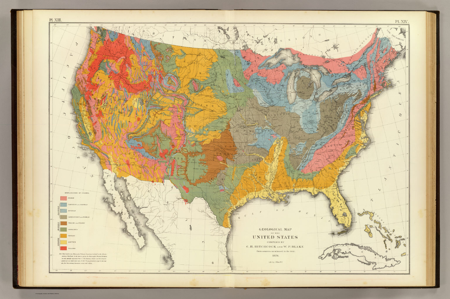
This is an index to some of our paper geology maps.
These websites contain information regarding geologic maps of the United States.
- National Geologic Map Database by the U.S. Geological Survey (USGS) – an interactive database with scans of most geological maps of the U.S. Click on "MapView".
This website is SO good and so fun. Be sure to use the "opacity" button to see the topographic maps, and aerial photographs underneath the geology maps. - U.S. Geological Survey (USGS) Publications Warehouse -- portal to all publications of U.S. Geological Survey (USGS). The Library owns most of the things listed in the Warehouse.
- Colorado Geological Survey -- located right here on Mines' campus.
- Links to State Geological Surveys -- by Association of American State Geologists (AASG)
- Scans of U.S. Geological Survey folios from the 1800s
- Macrostrat -- a platform of geological data exploration, integration, and analysis
International geologic maps:
British Geological Survey (BGS) scanned maps of the United Kingdom.